WELCOME TO RIVER DAVES PLACE

No-wake zones proposed for Refuge backwaters

hallett21

Well-Known Member
Joined
Nov 9, 2010
Messages
18,217
Reaction score
23,210
Having a hard time opening the link

It's proposing no air boats in the back bay behind topock 66. No kite surfing or hydra foiling south of the 40 bridge (basically the already 17 miles of no ski zone). No PWCs in the back bays off of Topock 66.

I forgot no hover crafts as well lol

And they want to lift a restriction on air cooled outboards
 

Deja_Vu

Essex Affectionado
Joined
Aug 4, 2014
Messages
6,262
Reaction score
4,759
The new regulations would:
? Prohibit kite-boarding and hydro-flight equipment in waters south of Interstate 40
? Prohibit boaters from launching watercraft or operating personal watercraft in areas including Beal Lake, Pintail Slough, Lost Lake and Topock Bay.
? Remove restrictions on air-cooled outboard engines.
? Prohibit use of hovercraft in refuge waters
? Stop allowing the use of air-thrust boats and air-cooled propulsion engines for all activities, including hunting and fishing.
Regulations called a compromise

A new proposal being floated by the U.S. Fish and Wildlife Service establishes a series of no-wake and restricted zones throughout Havasu National Wildlife Refuge backwaters.
The proposal released Wednesday is a compromise, according to Refuge Manager Richard Meyers, after public outcry against stricter proposals in 2016. While the U.S. Fish and Wildlife service has some restrictions in mind for Refuge boaters, Meyers says those restrictions will do little to obstruct recreational boating in the Refuge or on the Colorado River.
?We wanted to make sure there was no confusion,? Meyers said. ?We heard from all sides last year. There was a lot of confusion in the public...people believed we wanted to make the entire Refuge a ?no-wake? zone. That isn?t the case.?

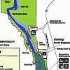
A map showing the southern portion of Havasu Refuge backwaters.
Courtesy of U.S. Fish and Wildlife Service


59702c5d88505.image.jpg


?Without the proper coordinates it?s hard to tell, but it looks like they?re running it up the center of the river, beginning at the mouth of the river,? Johnson said.
The no wake zones are established, according to the document, to protect wildlife resources and endangered species. The document points to several species of birds and fish, some that are listed as endangered, who depend on the refuge?s undisturbed natural habitat to survive.
?Though boating is an activity the Refuge is continuing to support for wildlife-dependent recreation, protection and recovery of wildlife necessitate establishment of no-wake zones in all backwaters,? the document stated.

Nexsen said some of the no wake zones presented simply codify already existing buoy areas near I-40 and Devil?s Elbow so authorities can better enforce those rules.
?Those are honestly both good things because those are very dangerous areas if you?re going any speed at all,? Nexsen said.

RD points out some things
575cc184c97e2.image.jpg
 

Singleton

Well-Known Member
Joined
Feb 5, 2008
Messages
19,020
Reaction score
25,667
Read the documents this morning, my biggest concern is the light blue area on the map (area marked as backwaters). Would like to know where that starts and stops. If it gets into main channel of river we got issues, if east and in the weeds only concern is do future extensions require public meetings as well
 

Old Texan

Honorary Warden #377 Emeritus - R.I.P.
Joined
Dec 19, 2007
Messages
24,479
Reaction score
25,980
I don't know the area and likely will not boat there, so I reserve comment.

But what I will comment on is air boats. Cool to use in the Glades and LA swamps, but I hate those things in TX coastal marshes and bays where I love to fish. Obnoxious and loud and turn off the bite when they fly by. I just hate those noisy bastards and most of the idiots that run them without regard to the sanctity of others. They just are not environmentally friendly and should be limited to where they can be operated. :thumbsdown

In the meantime, good luck on beating back bad rules and issues that are uncalled for.......:thumbsup
 

RiverDave

In it to win it
Joined
Sep 13, 2007
Messages
126,076
Reaction score
164,056
So was 2ff right? Having a hard time opening the link

Read the documents this morning, my biggest concern is the light blue area on the map (area marked as backwaters). Would like to know where that starts and stops. If it gets into main channel of river we got issues, if east and in the weeds only concern is do future extensions require public meetings as well


I got the CD yesterday afternoon.. and that's basically verbatim what I said to the newspaper last night. If you look at the picture they are running the light blue portion from the CA / AZ divide line east. I believe their "intent" is to say anything out in the reeds is no wake, but the way it's drawn it looks like the eastern half of the river is no wake, which is taking a narrow situation and making it even narrower.


The front half of that CD reads a whole lot different than the old one. Every single statement is backed up with some court case etc... That was also a little concerning.

If I can figure out a way to change it from pdf to .jpg I will upload it here.

RD
 

RiverDave

In it to win it
Joined
Sep 13, 2007
Messages
126,076
Reaction score
164,056
I vote squash it all.

What they are proposing (IMO) doesn't really affect normal boating activities on the lake / river. Their is a small purple section down actually on the lake that is no motorized vehicles.. That's for kayaks only at this point, so "technically" a small portion of Havasu is being closed, but according to that diagram it's pretty close to shore, so I don't think most would even notice? That is also providing the light blue area isn't from the center of the river east of course... which I don't think is their "intent" even though that's what it shows on that diagram. Hard to say, but I think that will be answered on Aug 17th at the public meeting.


What I don't get is why they are so concerned about these marsh areas? They make it sound like people are ripping through these areas that are completely infested with tree stumps? During all of the meetings last year there was only a handful of guys total (Maybe 6-10?) that ran little John Boats to fish those areas? Why are they so concerned with HP limits, and all this other stuff when none of it is happening anyways?

RD
 

02HoWaRd26

DCBroke
Joined
Dec 19, 2007
Messages
12,183
Reaction score
28,999
They definitely used good lawyers on this proposal. Look at the key items here, the key items are the "vague" items. Such as use of "south of Interstate 40" that could potentially effect all water ways south of I40 actual Lake Havasu, Parker River, & Blythe on down. Anytime they don't want to word something very specific and black and white it's because they are creating the gray area so they can later add . bullet points down wins and creates further exponential for varying the proposal after written as law. And it'll be easy as people will vote yes as the initial ""compromise"" as they so easy spoke of, sounds so much better then original proposal.


Sounds like some dirty politicians that have some ulterior motive based on some hidden agenda that's being paid for by someone or some organization that seeks further use of the water and surrounding land either right there or somewhere down the line that needs these intact to make their real money.

The majority of the Tri State area Economy comes from two things "BOAT" a place to burn you're money when it's too hot to off-road and "OFF-ROAD" a place to burn you're money when it's too cold to boat.
 

Enen

Well-Known Member
Joined
Aug 9, 2008
Messages
6,045
Reaction score
4,160
What they are proposing (IMO) doesn't really affect normal boating activities on the lake / river. That is providing the light blue area isn't from the center of the river east of course... which I don't think is their "intent" even though that's what it shows on that diagram. Hard to say, but I think that will be answered on Aug 17th at the public meeting.


What I don't get is why they are so concerned about these marsh areas? They make it sound like people are ripping through these areas that are completely infested with tree stumps? During all of the meetings last year there was only a handful of guys total (Maybe 6-10?) that ran little John Boats to fish those areas? Why are they so concerned with HP limits, and all this other stuff when none of it is happening anyways?

RD

It's how they start. Next year they will push to extend the boundaries because of all the success these regulations are having. It's like the frog simmering in a warm pot of water. They are slowly turning up the heat.
 

RiverDave

In it to win it
Joined
Sep 13, 2007
Messages
126,076
Reaction score
164,056
It's how they start. Next year they will push to extend the boundaries because of all the success these regulations are having. It's like the frog simmering in a warm pot of water. They are slowly turning up the heat.

The CD's happen every five years.

In short the refuge HAS TO do a Compatability Determination every five years, or potentially lose it's refuge status.

RD
 

02HoWaRd26

DCBroke
Joined
Dec 19, 2007
Messages
12,183
Reaction score
28,999
What they are proposing (IMO) doesn't really affect normal boating activities on the lake / river. Their is a small purple section down actually on the lake that is no motorized vehicles.. That's for kayaks only at this point, so "technically" a small portion of Havasu is being closed, but according to that diagram it's pretty close to shore, so I don't think most would even notice? That is also providing the light blue area isn't from the center of the river east of course... which I don't think is their "intent" even though that's what it shows on that diagram. Hard to say, but I think that will be answered on Aug 17th at the public meeting.


What I don't get is why they are so concerned about these marsh areas? They make it sound like people are ripping through these areas that are completely infested with tree stumps? During all of the meetings last year there was only a handful of guys total (Maybe 6-10?) that ran little John Boats to fish those areas? Why are they so concerned with HP limits, and all this other stuff when none of it is happening anyways?

RD


No disrespect but I feel you as a local entrepreneur business man that a portion of you're money comes from the walks
Of life called boating you my friend are reading into their words "compromise" just as they hoped.

You give a little they want to take more, and any waterways given will NEVER be retrieved back to the boating community.
What is a better way is to do without the .gov and create "handshake agreements" upon different social sections, that would simply only be correct by the informed. Such as those that know and respect others will not use X area for power boating and those will not kayak through Z areas of waterways.
 

02HoWaRd26

DCBroke
Joined
Dec 19, 2007
Messages
12,183
Reaction score
28,999
It's how they start. Next year they will push to extend the boundaries because of all the success these regulations are having. It's like the frog simmering in a warm pot of water. They are slowly turning up the heat.


My last two rants/posts are this exactly. Enen gets it.
 

hallett21

Well-Known Member
Joined
Nov 9, 2010
Messages
18,217
Reaction score
23,210
What they are proposing (IMO) doesn't really affect normal boating activities on the lake / river. Their is a small purple section down actually on the lake that is no motorized vehicles.. That's for kayaks only at this point, so "technically" a small portion of Havasu is being closed, but according to that diagram it's pretty close to shore, so I don't think most would even notice? That is also providing the light blue area isn't from the center of the river east of course... which I don't think is their "intent" even though that's what it shows on that diagram. Hard to say, but I think that will be answered on Aug 17th at the public meeting.


What I don't get is why they are so concerned about these marsh areas? They make it sound like people are ripping through these areas that are completely infested with tree stumps? During all of the meetings last year there was only a handful of guys total (Maybe 6-10?) that ran little John Boats to fish those areas? Why are they so concerned with HP limits, and all this other stuff when none of it is happening anyways?

RD

That's why I say squash it. It really isn't warranted in the first place. And secondly it adds more regulation to what appears to be an already self regulated location.

At those meetings was the topock marsh used by the Jon boat guys more in the winter or summer?
 

LargeOrangeFont

We aren't happy until you aren't happy
Joined
Sep 4, 2015
Messages
49,689
Reaction score
76,178
How did 2ff know about this weeks before everyone else? Everyone kind of laughed when I'm posted the last thread

Fish and Wildlife TOLD everyone they would return with a new draft proposal last year when the first one got squashed. This is not a surprise, and 2FF is not a prophet. They specifically said they are not moving existing buoys.
 

RiverDave

In it to win it
Joined
Sep 13, 2007
Messages
126,076
Reaction score
164,056
No disrespect but I feel you as a local entrepreneur business man that a portion of you're money comes from the walks
Of life called boating you my friend are reading into their words "compromise" just as they hoped.

You give a little they want to take more, and any waterways given will NEVER be retrieved back to the boating community.
What is a better way is to do without the .gov and create "handshake agreements" upon different social sections, that would simply only be correct by the informed. Such as those that know and respect others will not use X area for power boating and those will not kayak through Z areas of waterways.


The only compromise is that little purple area in mesquite bay for kayakers. The Ride Spot is open again, the large corner that was originally proposed is gone now.. The only question mark in the whole equation is what is the light blue areas actual boundaries to the west.

So if that's the compromise I'm good with it.

RD
 

MSum661

Well-Known Member
Joined
Sep 20, 2014
Messages
4,524
Reaction score
6,829
Read the documents this morning, my biggest concern is the light blue area on the map (area marked as backwaters). Would like to know where that starts and stops. If it gets into main channel of river we got issues, if east and in the weeds only concern is do future extensions require public meetings as well

Good Eye....Sure looks like another way to get around to the back door...lol.

CD 2016.jpg
Map.jpg
 

BHC Vic

cobra performance boats
Joined
May 24, 2014
Messages
25,623
Reaction score
20,161
Fish and Wildlife TOLD everyone they would return with a new draft proposal last year when the first one got squashed. This is not a surprise, and 2FF is not a prophet. They specifically said they are not moving existing buoys.

Ok as long as that's what they said 😂
 

TRAVISD

Active Member
Joined
Apr 22, 2014
Messages
41
Reaction score
27
Remember, what ever they take we will not get back. It needs a clear boundary of the area.
 

RiverDave

In it to win it
Joined
Sep 13, 2007
Messages
126,076
Reaction score
164,056
My last two rants/posts are this exactly. Enen gets it.

Well outside of your rants / posts.. What specifically did you do last time around when the proposal wasn't in the interest of boaters? Because judging me and saying I'm compromising and playing into their hand isn't really called for.

That's why I say squash it. It really isn't warranted in the first place. And secondly it adds more regulation to what appears to be an already self regulated location.

At those meetings was the topock marsh used by the Jon boat guys more in the winter or summer?

If you aren't happy with the CD, there's nothing stopping you from organizing people and going to take on the USFWS. I have already invested 100's of hours into this thing and thousands of dollars. I still have 5,000+ petitions sitting in my office, and up until recently I had a girl working for me entering the contact information into a excel spreadsheet on her spare time.. I was doing all of that in case this thing did go sideways it would be easy to organize up thousands of people to help fund the upcoming legal campaign etc..

Personally, if that light blue area is in the reeds.. I believe it's gonna have no impact on boaters.. and I'm not going to waste anymore time on some HP regulation or No Wake regulation, on what you accurately described as a self regulating situation anyways. It's infested with tree stumps.. LOL nobody is ripping through there anyways.

Fish and Wildlife TOLD everyone they would return with a new draft proposal last year when the first one got squashed. This is not a surprise, and 2FF is not a prophet. They specifically said they are not moving existing buoys.

Bingo.

RD
 

RiverDave

In it to win it
Joined
Sep 13, 2007
Messages
126,076
Reaction score
164,056
This all said, I would absolutely encourage everyone to go to the public comment session on Aug 17! If for some reason that light blue area is on the CA / AZ dividing line then we are gonna need all the support we can get.
 

BHC Vic

cobra performance boats
Joined
May 24, 2014
Messages
25,623
Reaction score
20,161
If you're not worried I'm not worried 😎
 

rivrbrat

Well-Known Member
Joined
Oct 4, 2007
Messages
155
Reaction score
73
1. Disneyland would be off limits.

2. Gasoline ally would be off limits.

3.How do you get a natural habitat out of a man made lake?

BS. Vote no on all of it.....................

They have already put in place 2 no wake zones from Laughlin to Havasu they need to roll those back and go protect some other Fawken lake.
 

USMC2010

Well-Known Member
Joined
Mar 14, 2014
Messages
4,167
Reaction score
6,499
Could they have picked a smaller location for the public meeting? Last year was standing room only at the aquatic center.
 

RiverDave

In it to win it
Joined
Sep 13, 2007
Messages
126,076
Reaction score
164,056
1. Disneyland would be off limits.

2. Gasoline ally would be off limits.

3.How do you get a natural habitat out of a man made lake?

BS. Vote no on all of it.....................

They have already put in place 2 no wake zones from Laughlin to Havasu they need to roll those back and go protect some other Fawken lake.

I think you are confusing off limits with no wake.. which they already are no wake?
 

RiverDave

In it to win it
Joined
Sep 13, 2007
Messages
126,076
Reaction score
164,056
Could they have picked a smaller location for the public meeting? Last year was standing room only at the aquatic center.

Did they announce where it was going to be already? I didn't see that in the CD anywhere?

RD
 

Taboma

Well-Known Member
Joined
Apr 4, 2008
Messages
15,438
Reaction score
22,250
Here's a little different perspective using Google Maps Sat --- estimate of course but I think I got it pretty close.

This is just the lake end, as I don't believe we boaters care about the Topock Marsh area.

Refuge CD marked copy.jpg
 

USMC2010

Well-Known Member
Joined
Mar 14, 2014
Messages
4,167
Reaction score
6,499
It was at the bottom of the newspaper article.

The U.S. Fish and Wildlife Service will host a public forum to discuss its proposal with the Havasu public from noon to 6 p.m. on Aug. 17. It will be held in the Sir Lancelot Room at London Bridge Resort. Attendees can hear a presentation on the proposal and submit written feedback about the proposals.
 

Joker

Well-Known Member
Joined
Dec 19, 2007
Messages
19,864
Reaction score
15,335
If you're not worried I'm not worried [emoji41]

Vic,
This has no effect on our boating fun unless you're that interested in driving to Havasu only to come home with a stomach virus and a green boat.[emoji106]
 

BHC Vic

cobra performance boats
Joined
May 24, 2014
Messages
25,623
Reaction score
20,161
Vic,
This has no effect on our boating fun unless you're that interested in driving to Havasu only to come home with a stomach virus and a green boat.[emoji106]

Yup... it really just leaves the best boating for us 😎
 

RiverDave

In it to win it
Joined
Sep 13, 2007
Messages
126,076
Reaction score
164,056
Here's a little different perspective using Google Maps Sat --- estimate of course but I think I got it pretty close.

This is just the lake end, as I don't believe we boaters care about the Topock Marsh area.

View attachment 575321

Thank you for that.

It was at the bottom of the newspaper article.

The U.S. Fish and Wildlife Service will host a public forum to discuss its proposal with the Havasu public from noon to 6 p.m. on Aug. 17. It will be held in the Sir Lancelot Room at London Bridge Resort. Attendees can hear a presentation on the proposal and submit written feedback about the proposals.

Thanks.. I only read the CD, didn't get a chance to read the news paper article.

They are already no wake zones.............Go look they snuk those bouys in about 6 years ago.
/
I know, that's what I was saying. Under this CD they are no wake zones.. but why would it matter? Because they are already no wake zones.

RD
 

RiverDave

In it to win it
Joined
Sep 13, 2007
Messages
126,076
Reaction score
164,056
So in Summation, the only thing this CD is doing is giving the kayakers a small area in Mesquite Bay that is off limits to power boats.

RD
 

hallett21

Well-Known Member
Joined
Nov 9, 2010
Messages
18,217
Reaction score
23,210
So in Summation, the only thing this CD is doing is giving the kayakers a small area in Mesquite Bay that is off limits to power boats.

RD

Which in reality are boaters even going in there? Just seems like a lot of "new" regulation that isn't needed.
 

rivrbrat

Well-Known Member
Joined
Oct 4, 2007
Messages
155
Reaction score
73
You guys are missing the big picture. They are trying to clean up the illegal restrictions/no Wake zones already put in place a number of years ago Topoc, devils elbow, disneyland, & Gasoline ally these no wake zones were put in place with any public comment.
 

spectra3279

Vaginamoney broke
Joined
May 17, 2011
Messages
16,886
Reaction score
17,851
What they are proposing (IMO) doesn't really affect normal boating activities on the lake / river. Their is a small purple section down actually on the lake that is no motorized vehicles.. That's for kayaks only at this point, so "technically" a small portion of Havasu is being closed, but according to that diagram it's pretty close to shore, so I don't think most would even notice? That is also providing the light blue area isn't from the center of the river east of course... which I don't think is their "intent" even though that's what it shows on that diagram. Hard to say, but I think that will be answered on Aug 17th at the public meeting.


What I don't get is why they are so concerned about these marsh areas? They make it sound like people are ripping through these areas that are completely infested with tree stumps? During all of the meetings last year there was only a handful of guys total (Maybe 6-10?) that ran little John Boats to fish those areas? Why are they so concerned with HP limits, and all this other stuff when none of it is happening anyways?

RD
Give an inch they will take 10 miles. And who to say they won't change the locations afterwards.
 

spectra3279

Vaginamoney broke
Joined
May 17, 2011
Messages
16,886
Reaction score
17,851
Fish and Wildlife TOLD everyone they would return with a new draft proposal last year when the first one got squashed. This is not a surprise, and 2FF is not a prophet. They specifically said they are not moving existing buoys.
No. They are just going to add more bouys.
 

Havasteve

Well-Known Member
Joined
Apr 22, 2008
Messages
928
Reaction score
697
I think they're just putting their jack booted foot in the door in an area we aren't overly affected by like Topock Marsh hoping we keep looking at some unofficial vague map.

Once they have control and patrol protocol of those areas thay can just wait till things calm down and then some cold winter day the bouys start to move outward into new areas. It's happened before. None of this means anything if they can just move the bouys.

I think its important to require a list of bouys and their exact Lat/Long location so they cant just be dragged to a new location. This would also enable a person to enter these waypoints into their chart plotter, GPS device or Google Earth.

Its a safety issue.

I think they should be using only real maps like USGS maps none of this hame made crap that eliminates the California shoreline.

They know exactly what they're doing.
 

Havasteve

Well-Known Member
Joined
Apr 22, 2008
Messages
928
Reaction score
697
It was at the bottom of the newspaper article.

The U.S. Fish and Wildlife Service will host a public forum to discuss its proposal with the Havasu public from noon to 6 p.m. on Aug. 17. It will be held in the Sir Lancelot Room at London Bridge Resort. Attendees can hear a presentation on the proposal and submit written feedback about the proposals.

I wonder if they will be answering questions from the public?
 

Havasteve

Well-Known Member
Joined
Apr 22, 2008
Messages
928
Reaction score
697
Give an inch they will take 10 miles. And who to say they won't change the locations afterwards.

Years ago, the no motorized vessel bouy line outside both Mesquite bays mysteriously moved out into the lake. They remain ere today.

When they set these bouys they just put them where they want.
 

TCHB

Well-Known Member
Joined
Jan 24, 2008
Messages
11,096
Reaction score
8,010
As they continue to close areas the noise levels will come into play. Not good.
 
Top